Search:
Gillingham
This small town was once at the heart of the Royal Forest of Gillingham. Records show that King John (1199–1216) and Henry III (1216–1272) both spent considerable sums on a Royal residence built just to the east of the current settlement. The residence was demolished shortly after the death of Queen Philippa – wife of Edward III – in 1369.
|
|
|
|
|
|
|
|
|
|
|
To view any image full size - simply click on the thumbnail
| ||||
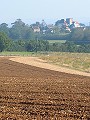
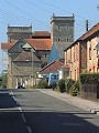
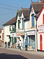
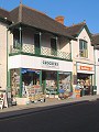
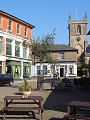
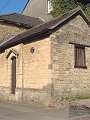
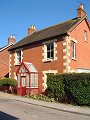
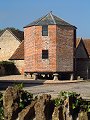
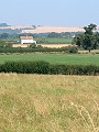
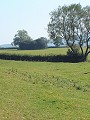
The arrival of the railway in 1859 promoted rapid expansion of what was then only a small village, the new station serving also the very much larger town of Shaftesbury – which is some 6km away – situated on a nearby hill-top. In recent years the railway has again encouraged expansion; Gillingham being just 2 hours travel from London. The town (in 2002) has the accolade of being ' the fastest growing small town in Europe.' The views displayed here show the town and surrounding area on a fine autumnal day at the start of September. The older buildings in the town, covering a wide range of dates and styles, are predominantly constructed from local limestone and locally made brick (which has vibrant red colour in this part of the county).
Find out more ... |
|
In the top row of pictures:
In the bottom row of pictures:
Nearby locations that also feature in galleries on this site: More views of Dorset in September Other sites on the webThe Dorset Page: Gillingham – local information and links to further resources on the web Maps of the area on streetmap.co.uk: 1:50,000 – detail, 1:250,000 – locality and route to get there
|