Search:
Marshwood Vale
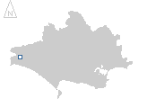
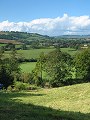
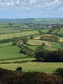
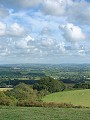
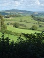
A bright day near the start of September gives ideal weather conditions for a 50km cycle-ride around the Marshwood Vale, located in the western part of the county. Drained by the River Char this wide and very flat, bowl shaped vale makes for easy cycling, unless one attempts to ascend the hills around the periphery – of which Pilsdon Pen, the highest at 277m is also the highest point in the county.
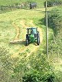
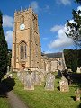
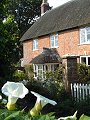
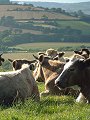
The Vale itself is mostly pasture, with scattered hamlets and farmsteads linked by narrow, winding lanes. The one village in the Vale – Whitchurch Canonicorum – is situated on the southern edge. Around the periphery and overlooking the Vale are to be found three Iron Age hillforts, each located on the flat summit of one of the Upper Greensand hillocks – Lambert's Castle, Coney's Castle and Pilsdon Pen.
|
|
|
|
|
|
|
|
|
|
|
To view any image full size - simply click on the thumbnail
| ||||
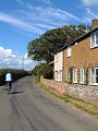
The circular cycle route started and ended at Bridport – the market town for the region – passing Pymore and Broadoak en-route to Pilson Pen. Following the descent off Pilsdon Pen is a climb to Lambert's Castle and a descent once more to Whitchurch Canonicorum, before finally returning to the start via the attractive villages of North Chideock and Symondsbury.
Find out more ... |
|
In the top row of pictures:
In the bottom row of pictures:
Nearby locations that also feature in galleries on this site: More views of Dorset in September Other sites on the webThe Dorset Page: Whitchurch Canonicorum – local information and links to further resources on the web Maps of the area on streetmap.co.uk: 1:50,000 – detail, 1:250,000 – locality and route to get there
|