location where the photographs were taken
find out morefind out more

  Search:

Bridport

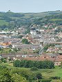
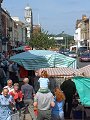
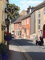
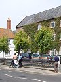
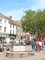
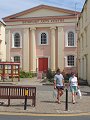
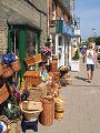
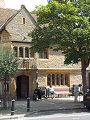
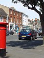
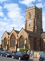
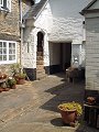
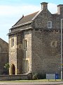
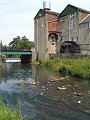
A market town serving the western side of Dorset, its growth and fame based on the manufacture of rope – an industry which started in the town in the 13th century. The three main streets meet at the Town Hall, the clock tower and white painted cupola of which form a distinctive landmark. Most houses in the heart of the town date from the 18th and 19th century, a 14th–15th century fortified house towards the end of South street being the oldest standing secular building in the town. The pictures shown here were taken on a market day in mid-July.


033-01 Bridport 033-02 Bridport 033-03 Bridport 033-04 Bridport 033-05 Bridport
033-06 Bridport 033-07 Bridport 033-08 Bridport 033-09 Bridport 033-10 Bridport
033-11 Bridport 033-12 Bridport 033-13 Bridport 033-14 Bridport 033-15 Bridport
To view any image full size - simply click on the thumbnail
  

Find out more ...

In the top row of pictures:

  • View westards across Bridport, from a nearby hillside (SY 473 924) (picture)
  • East Street, Town Hall and cupola, Colmers Hill in the distance (picture)
  • Barrack Street, the frontages are typical of the many small streets leading off East and West Street (picture)
  • Market stalls on East Street (picture)
  • A quiet moment, at the bottom of West Street (picture)

In the middle row of pictures:

  • Former rope factory, at the bottom end of West Street (picture)
  • Bucky-Doo Square and Town Hall (built 1785–6 by William Tyler) (picture)
  • The Arts Centre, former Wesleyan Chapel, built 1838 (picture)
  • Just one of the many small shop fronts on South Street (picture)
  • The Castle, now Museum and Art Galley, 16th century frontage (picture)

In the bottom row of pictures:

  • South Street (picture)
  • Church of St Mary, mostly Early English and Perpendicular (13th–16th century) (picture)
  • Interior courtyard, Friends' Meeting House and Almshouses (picture)
  • The Chantry, 14th or 15th century building at the southern end of South Street, believed to be possibly a semi-fortified tower-house (picture)
  • Powering its undershot waterwheel with water from the River Brit, Palmers Brewery at the end of South Street, in operation since 1794 (picture)

Nearby locations that also feature in galleries on this site:

directionBeaminster

directionPowerstock, Bride Valley, Puncknowle

directionWest Bay

directionGolden Cap, Lyme Regis, Marshwood Vale

More views of Dorset in July


Other sites on the web

Bridport and West Bay:   The official town website

The Dorset Page:   Bridport – local information and links to further resources on the web

Maps of the area on streetmap.co.uk:   1:50,000 – detail, 1:250,000 – locality and route to get there

picture resolution
The pictures of Bridport in this gallery were captured at high resolution.
This is images of dorset stock photography gallery 033
All photographs copyright © 1998–2003 John Allen


top of page