location where the photographs were taken
find out morefind out more

  Search:

Hengistbury Head

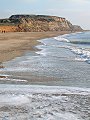
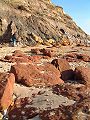
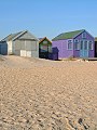
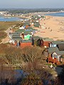
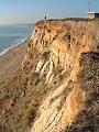
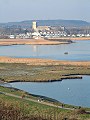
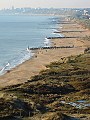
Forming the south side of Christchurch Harbour, the spit of land known as Hengistbury Head has been a site inhabited by man for at least 12,000 years. Although reaching not much more than 30m above sea-level the views from this protected nature reserve can be spectacular: from Swanage and Purbeck in the south-west, past the long beaches of Bournemouth and the historic town of Christchurch to the chalk cliffs of the Isle of Wight in the south-east. Seen here on a bright day, early in January.


011-01 Hengistbury Head 011-02 Hengistbury Head 011-03 Hengistbury Head 011-04 Hengistbury Head 011-05 Hengistbury Head
011-06 Hengistbury Head 011-07 Hengistbury Head 011-08 Hengistbury Head 011-09 Hengistbury Head 011-10 Hengistbury Head
To view any image full size - simply click on the thumbnail
  

Find out more ...

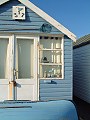
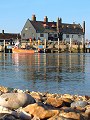
In the top row of pictures:

  • Hengistbury Head from its western end (picture)
  • Along most of its length the soft clays and sands of the headland are exposed directly to the sea, a classic area to study coastal erosion (picture)
  • Beach huts on the sand spit opposite Mudeford, much sought after these can cost £20,000+ (picture)
  • Why people return time and time again (picture)
  • Why people return time and time again (picture)

In the bottom row of pictures:

  • Across the narrow channel leading into Christchurch Harbour – Mudeford (picture)
  • The beach huts form a small shanty town, mainly deserted during winter months (picture)
  • The summit of Hengistbury Head with former coastguard lookout, the soft cliffs slipping inexorably into the sea (picture)
  • Looking northwards from the summit across the bay to Christchurch and Christchurch Priory (picture)
  • The view westwards from on top of Hengistbury Head, Bournemouth in the distance, groynes spaced evenly along the coastline to slow the erosion (picture)

Nearby locations that also feature in galleries on this site:

directionChristchurch

directionBournemouth

More views of Dorset in January


Other sites on the web

Hengistbury Head:   Bill Rees' comprehensive guide to the geology and coastal protection issues of this headland.

West's Geology Field Guide to the cliffs of Bournemouth, and coast erosion east of this spit

Maps of the area on streetmap.co.uk:   1:50,000 – detail, 1:250,000 – locality and route to get there

picture resolution
The pictures of Hengistbury Head in this gallery were captured at high resolution.
This is images of dorset stock photography gallery 011
All photographs copyright © 1998–2003 John Allen


top of page