Search:
Ballard Down
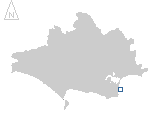
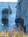
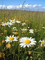
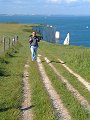
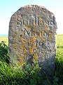
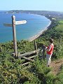
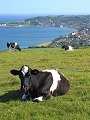
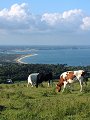
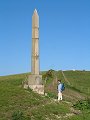
A fine June day, ideal conditions in which to enjoy the extensive views possible from high on the chalk ridge known as Ballard Down. Starting at Handfast Point (SZ 053 825) and the famous chalk sea-stack 'Old Harry', the path followed in this gallery simply heads westwards along the crest of the ridge – past 'The Pinnacles' – reaching the summit 162m above sea level at Ballard Point, then on along the ridge to the obelisk set up to commemorate the provision of a new water supply to Swanage in 1892 (SZ 022 813).
|
|
|
|
|
|
|
|
|
|
|
To view any image full size - simply click on the thumbnail
| ||||
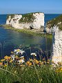
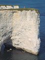
Old Harry and Handfast Point mark the easternmost end of the 'Jurassic Coast', the name given to this recently (December 2001) designated UNESCO World Heritage Site. The chalk cliffs at this end of the Dorset coast are the youngest rocks on the site, being deposited during the Upper Cretaceous period, some 70–90 million years ago. From here you can travel westwards along the coast, the fossil remains along the route telling a story that takes you progressively further and further back through time.
Find out more ... |
|
In the top row of pictures:
In the bottom row of pictures:
See also: Swanage to Sandbanks, and photo: wave erosion at the foot of Ballard Down cliffs Nearby locations that also feature in galleries on this site: More views of Dorset in June Other sites on the webThe coastline shown here forms part of the Jurassic Coast World Heritage Site West's Geology Field Guide to the Studland Peninsula and Ballard Down area Maps of the area on streetmap.co.uk: 1:50,000 – detail, 1:250,000 – locality and route to get there
|