Search:
Plush and Dorsetshire Gap
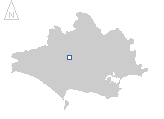
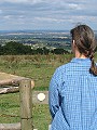
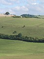
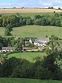
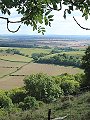
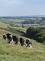
A small collection of houses set amongst chalk downs in an area dotted with evidence of habitation from medieval, Iron Age and Neolithic times. Field systems (terracing, banks of enclosures) cross dykes, tumuli and sites of settlements can be found on almost every hill in this area. The downs here reach a height of 260m above sea level; from the highest points one can see Exmoor to the west, the Mendip hills to the north, the Isle of Wight to the east and the ridges above Weymouth in the south. These extensive views in all directions across the whole county probably prompted the name Dorsetshire Gap being given to this crossing of ancient paths.
|
|
|
|
|
|
|
|
|
|
|
To view any image full size - simply click on the thumbnail
| ||||
Find out more ... |
|
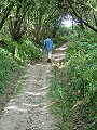
In the top row of pictures:
In the bottom row of pictures:
Nearby locations that also feature in galleries on this site:
More views of Dorset in September Other sites on the webThe Dorset Page: Plush – local information and links to further resources on the web Maps of the area on streetmap.co.uk (Plush): 1:50,000 – detail, 1:250,000 – locality and route to get there Maps of the area on streetmap.co.uk (Dorsetshire Gap): 1:50,000 – detail, 1:250,000 – locality and route to get there
|