
Search:
West Bay
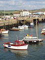
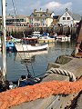
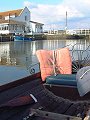
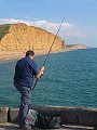
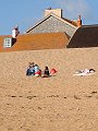
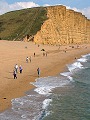
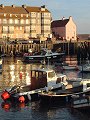
Originally Bridport Harbour, this small collection of houses, pubs and hotels was renamed West Bay in 1884 in an attempt to develop the area as a resort when the railway was extended down to the harbour. Popularised at the end of the 20th century by a television drama series set in the village and served by a large caravan park it receives a large number of visitors in summer months, some of the original tranquillity of this small fishing hamlet can still be found in the out-of-season months. Seen here late afternoon at the end of September.
|
|

|
|
|
|
|

|

|
|
|
To view any image full size - simply click on the thumbnail
| ||||
Find out more ... |
|
In the top row of pictures:
In the bottom row of pictures:
See also photo: fishermen, West Bay Nearby locations that also feature in galleries on this site: More views of Dorset in September Other sites on the webThe coastline shown here forms part of the Jurassic Coast World Heritage Site West's Geology Field Guide to the Bridport Area - Pt.1 West Bay The Dorset Page: West Bay – local information and links to further resources on the web Maps of the area on streetmap.co.uk: 1:50,000 – detail, 1:250,000 – locality and route to get there
|