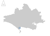
location where the photographs were taken
find out morefind out more

  Search:

Weymouth

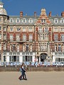
A port since medieval times, Weymouth takes its name from the original settlement on the west bank of the River Wey, the settlement on the east bank was Melcombe Regis (through which the Black Death arrived in England, in 1348). The two towns were united in 1571, retaining the name of Weymouth, although the majority of the growth in the combined town was on the east side of the river.

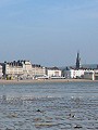
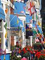
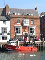
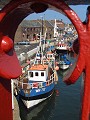
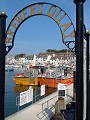
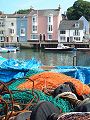
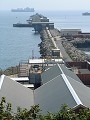
Weymouth became a major sea-side resort during the latter half of the 18th century, with King George III paying regular visits from 1789 to about 1805. Now still a popular beach and boating resort, although eclipsed somewhat by Bournemouth, the town still retains a working port.


024-01 Weymouth 024-02 Weymouth 024-03 Weymouth 024-04 Weymouth 024-05 Weymouth
024-06 Weymouth 024-07 Weymouth 024-08 Weymouth 024-09 Weymouth 024-10 Weymouth
024-11 Weymouth 024-12 Weymouth 024-13 Weymouth 024-14 Weymouth 024-15 Weymouth
To view any image full size - simply click on the thumbnail
  

Find out more ...

In the top row of pictures:

  • View across the beach at low tide to the long, south-east facing Esplanade (picture)
  • Statue of George III, erected at the southern end of the Esplanade by the local inhabitants in 1809, in gratitude for his patronage (picture)
  • The Esplanade and the Jubilee Memorial Clock Tower, for the Golden Jubilee of Queen Victoria in 1887 (picture)
  • Guest houses and small hotels crowd the sea-front ... (picture)
  • ... whilst at the other end of the scale is the Royal Hotel, overlooking the centre of the Esplanade, dating from 1887–9 and built in a style termed 'Free Renaissance' (picture)

In the middle row of pictures:

  • Inland – overlooking Radipole Lake – the small visitor centre at the RSPB bird reserve (picture)
  • Fronting onto the harbour quay, the Custom House and other warehouses (picture)
  • View from the Town Bridge along Custom House Quay (picture)
  • The recently re-developed Brewer's Quay, on the western side of the River Wey (picture)
  • View across the River Wey, terrace of houses along the western side of Weymouth Harbour (picture)

In the bottom row of pictures:

  • View out along Bincleaves Groyne, one of the breakwaters making up Portland harbour which was built in 1849–1903 to provide safe anchorage for Naval and commercial ships (picture)
  • Guarding the entrance to Weymouth harbour, Nothe fort, built 1860–72, one of several constructed along the south coast to defend harbours and naval installations (picture)
  • One of several recently re-furbished terraces on the west bank of the river around Brewers Quay (picture)
  • The centre of the town has also recently undergone redevelopment, Lower Bond Street and the White Hart Inn – one of the larger buildings surving from 17th century Weymouth (picture)
  • Mid-day in the summer, the scene down St Mary Street attests to the continuing popularity of the resort (picture)

See also: the harbour in winter

Nearby locations that also feature in galleries on this site:

directionUpwey, Dorchester

directionOsmington

directionFortuneswell, Portland

directionFleet and Langton Herring, Abbotsbury

More views of Dorset in July


Other sites on the web

Weymouth & Portland Borough Council:   the official town website

The Royal Society for the Protection of Birds (RSPB):   manage the nature reserve at Radipole Lake – events, visitor access and directions to the reserve can be found on their Radipole Lake reserve page.

The Dorset Page:   Weymouth – local information and links to further resources on the web

Maps of the area on streetmap.co.uk:   1:50,000 – detail, 1:250,000 – locality and route to get there

picture resolution
The pictures of Weymouth in this gallery were captured at high resolution.
This is images of dorset stock photography gallery 024
All photographs copyright © 1998–2003 John Allen


top of page