Search:
Sturminster Marshall
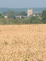
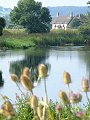
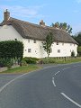
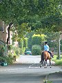
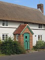
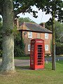
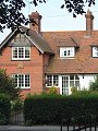
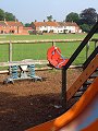
A large village situated in the Stour valley, it has a small core of older houses – several 18th century – but some dated earlier, and is one of the few villages in the area containing timber-framed cottages. The village has expanded rapidly in recent years as a result of its proximity to Poole and Bournemouth, resulting in a varied mix of building styles. Seen here early on a mid-August morning, well before the sun's light had reached its full strength.
|
|
|
|
|
|
|
|
|
|
|
To view any image full size - simply click on the thumbnail
| ||||
Find out more ... |
|
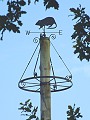
In the top row of pictures:
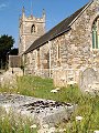
In the bottom row of pictures:
Nearby locations that also feature in galleries on this site: More views of Dorset in August Other sites on the webThe Dorset Page: Sturminster Marshall – local information and links to further resources on the web Maps of the area on streetmap.co.uk: 1:50,000 – detail, 1:250,000 – locality and route to get there
|